Government
That nice map... never mind
In the "security"-obsessed reality we live in, having something as simple as a not-very-high-resolution map of water pipes out there on the Internet is enough to make government-types wet their pants (water related puns
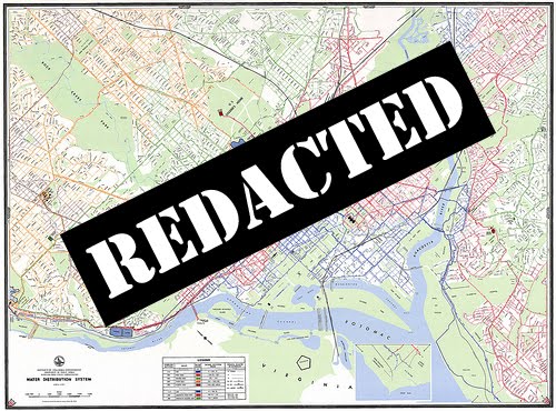
This morning, I received notice from Alan Heymann, the Public Affairs Director of DC Water, that the EPA contacted DC Water to let them know they believe the map is "sensitive information" and should not have been shared.
I'm not naive, and I understand the need for vigilance regarding threats to infrastructure in the nation's capital, but this information doesn't add much value for someone looking to do harm to our water supply. The easiest places to do so, the open-air reservoirs at Dalecarlia, Georgetown, and McMillan, are all well-guarded. Just try to take a photo at any of them, and a gruff person will threaten you with physical harm if you look in their direction for too long.
One of my mantras is "information wants to be free," so my initial response was to say, "Hell no, this is public property, and the public has a right to know about this." But Mr. Heymann has been a great help in solving the problem of "Montello Springs" as well as offering the tour of the Bryant Street Pumping Station, so we've decided on a compromise. The highest resolution version of the map has been removed from Flickr, and we're including an annotated version below that shows the location of the reservoirs.

You can still get the basic gist of our previous article from this map In thinking about all of this, Jaime discovered the EPA website called MyEnvironment, where they tout "transparency, transparency, transparency" and openness, and discuss the sharing of maps and data with the public. In light of the recommendation to remove this map, we asked Alan Heymann if he feels that sites like "MyEnvironment" can ever truly meet the goal of openness? Should government agencies set explicit limits on what is appropriate to share? Here's his response: The General Manager and the rest of the team were pleased to see your informative, thoughtful take on the distribution system on Tuesday. At the same time, especially because this is the nation's capital, we need to be mindful of security concerns. When the U.S. EPA mentioned to us that the posting of a detailed map online might put sensitive information into the wrong hands, I made the request that the map be removed from your post.
As you mentioned in the earlier post, our new name and logo are just part of an effort to connect with our customers in ways this agency has never done before. However, in hindsight, I probably erred a little too far on the side of openness and transparency in providing a high-resolution map of the distribution system for the web. I appreciate greatly your cooperation in agreeing to take it down, and I want to thank the GGW readers for their understanding as well. I'm looking forward to collaborating with you on future posts.I agree that generally, more information is better than less information. Many District residents don't know much about the facilities and the agency that supply their drinking water, which was the idea behind the bloggers' roundtable that you attended last week. Likewise, not everyone gets a chance to visit the inside of a pumping station, but you have the ability to take your audience there through your photos and words.
Cross-posted at The District Curmudgeon.
Comments
- Cyclists are special and do have their own rules
- M Street cycle track keeps improving, draws church anger
- Judge denies injunction against closing schools
- Metro policy for refunds after delays falls short, riders say
- O'Malley announces first projects using new gas tax money
- ICC losing bus service in classic bait and switch
- WMATA launches "Short Trip" rail pass on SmarTrip


by StuckinDC on Jun 24, 2010 3:51 pm • link • report
https://addons.mozilla.org/en-US/firefox/addon/2489/
by StuckinDC on Jun 24, 2010 3:52 pm • link • report
This is alas reminding me of of London, where the plainclothes religi^H^H^H terrorism police routinely harass and arrest people for taking pictures of St. John's Cathedral, which has been there since roughly 1700 AD!
by George B on Jun 24, 2010 4:05 pm • link • report
by Tim on Jun 24, 2010 4:05 pm • link • report
by M.V. Jantzen on Jun 24, 2010 4:09 pm • link • report
The point is that there not much information that can be gleaned from the decades-old map (April, 1985) that can't be found on any other of a number of publicly accessible sources.
And water infrastructure doesn't strike me as a particularly desirable target - its certainly easier to tamper with a whole host of other things. I don't know, maybe I'm not being imaginative enough: http://goo.gl/KYrV
by Bilsko on Jun 24, 2010 4:18 pm • link • report
by Teyo on Jun 24, 2010 4:24 pm • link • report
by Redline SOS on Jun 24, 2010 4:28 pm • link • report
It's kind of like how newspapers don't usually publish the names of rape and sexual assault victims (and alleged victims). It's not that it's illegal, it's just probably better that way.
by Tim on Jun 24, 2010 4:49 pm • link • report
by Kent on Jun 24, 2010 4:59 pm • link • report
Second reaction: a phrase like "we need to be mindful of security concerns" is nothing but weasel words. The paranoid ass-coverers say that about damn near anything these days, and those words are only meant to pre-emptively cut off any sort of rational discussion about actual security. What "security concerns" are there, really? And no, to have public information "fall into the wrong hands" doesn't cut it.
Third reaction: good luck with that re-barning, DC Water.
by thm on Jun 24, 2010 5:21 pm • link • report
A quick search on Google will turn up the locations of pumping stations, or one can just intuitively look for industrial-looking buildings along a river. And a *very* quick browse on Google Maps shows that rectangular blotches of blue are easy to spot & interpret as reservoirs.
by Bossi on Jun 24, 2010 5:22 pm • link • report
Anyway, I called up WASA public affairs and started asking some questions based on documents and maps I'd found. "Where did you get that information?" they asked. From your web site, I replied.
They took it down the next day.
Security theater was at its best then. I visited one reservoir and found the cop guarding it asleep in his car.
by TJ on Jun 24, 2010 5:23 pm • link • report
by ah on Jun 24, 2010 5:41 pm • link • report
I was starting to think about that, too... but it's easy to find those by looking for the metal plates on the ground stamped w/ the water logo. And while I haven't delved around DC's underground much (yet), if it's anything like other cities: you can pretty easily access these pipes via the myriad of unguarded manholes & unguarded sewer tunnels. Or at least I assume they're unguarded... I've never had an issue accessing them, at least. In general, larger pipes also tend to correlate with more trafficked roads -- providing an easy starting point for the mapless person in search of water mains.
...Or just wait until they crumble and erupt :)
by Bossi on Jun 24, 2010 5:49 pm • link • report
Also -- here's a question for the GGW community? I'm concerned about the Silver Line added to the already significantly congested Orange and Blue Lines. Has anyone thought about having a map where just the Silver and Orange lines go through the tunnel connecting Rosslyn and Foggy Bottom? The Blue Line could instead go from L'Enfant Plaza to Pentagon via the bridge with the Yellow Line, and continue from there to Franconia-Springfield?
This would mean that National Cemetary would need to be addressed perhaps by a "looping" Metro that circled between Rosslyn and Pentagon. What do you think?
I suggest this because then you'd have two lines (Orange and Silver) going through the Rosslyn-Foggy Bottom tunnel and two lines (Blue and Silver) going over the Pentagon-L'Enfant Plaza bridge. That seems like a much more balanced solution than Having a CLOGGED Orange-Blue-Silver mess all through Rosslyn. Thoughts?
I'd love to see a GGW map of such an idea for discussion.
Thanks!
by MetroThinker on Jun 24, 2010 7:11 pm • link • report
by ah on Jun 24, 2010 10:32 pm • link • report
by norb on Jun 25, 2010 10:00 am • link • report
by IMGoph on Jun 25, 2010 10:05 am • link • report
The *depths* of the pipes, or the *age* of the pipes, or other stuff like that, might not be blatantly obvious to any on-the-ground, in-the-library researcher. However there is absolutely nothing in a map of the piping layout which poses any greater security risk than, well, having a water system in the first place.
This reminds me of those bans on photographing public places: pure idiocy. The human brain does a perfectly good job of collecting this information. Hiding the map means that only terrorists will bother to figure out where the water lines are. Nothing more.
by Nathanael on Jun 25, 2010 10:39 am • link • report
That's what I was thinking. That map is interesting, but from a security perspective it reveals the shocking (!) fact that water mains run under the streets.
by Alex B. on Jun 25, 2010 10:43 am • link • report
by james on Jun 25, 2010 1:38 pm • link • report
by ann on Feb 5, 2011 8:47 pm • link • report
Add a Comment